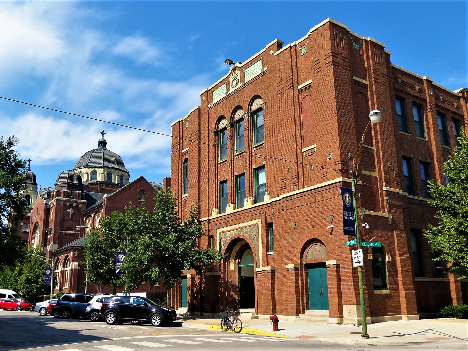
Holy Innocents School Hall (Worthmann & Steinbach, 1914) in Noble Square, 9/18/19
In 2003, I moved to Chicago and the Ukrainian Village neighborhood.
I choose it mostly because a friend was nearby, as one does. For 17 years I lived in several places within the same half mile square block. From the start, I would ride around and later look up the churches I was seeing, often to find the same architecture duo, Worthmann & Steinbach. This partnership of two German born Americans worked together from 1903 to 1928. They were responsible for a great number of Lutheran and Catholic churches as well as a larger number of standard Chicago residences (worker’s cottages, two and three flats, multifamily) and storefront flats. Often their buildings have interesting brick work designs. Some, though, are as functional looking as they come. Henry Worthmann designed their early office at 1859 Chicago Ave and he was a member of neighborhood St. John Evangelical Lutheran Church, designing the church and much of the 2200 block of Walton for other members.
For this map I have concentrated on Henry Worthmann’s output. The earliest buildings on the map are from the early 1890s and were done with then partner John K Neebe (who lived to 104). There are a few he did alone before the 1903 partnership with John G Steinbach. Around 1915 they added Clement Piontek who would go on to build even more buildings in the West Town neighborhoods with Joseph Slupkowski. Oh, the maps to be made!
Areas of note:
- The thirty or so buildings in Ukrainian Village, only when I started making these maps did I learn that they were the architects of so much of what I was seeing around me everyday.
- The Logan Square neighborhood.
- Streets in North Center developed by Charles and EJ Kimnetz
- Brighton Park’s Campbell Street development by WG McIntosh
At first posting, there are 289 buildings on the map. That number is not comprehensive or final. To find buildings, I have used issued permits published in American Contractor magazine from 1898-1912, Chicago Landmark District reports and the Chicago Historical Resource Survey (CHRS) 1983-1995. I have a lot more digital issues of the American Contractor and other contemporary building periodicals to shift through, so expect on-going updates. If you think I’ve made an error, please let me know. We are often dealing with two separate periods of street number and name changes and digitized documents with hard to read old era type, so I’m all ears.
The markers include:
- Picture (112 of 290, to be updated)
- Building Year
- The original street name and/or number
- CHRS color rating if applicable
- Links to more info, usually for bigger or more well known buildings
Contact me for half or full day custom guided rides and gift certificates, or find this map with other points of interest on The Map to plan your own ride, run, or walk.
Sources: American Contractor, Chicago Historical Resource Survey, Landmark District Reports, architect icon by Icons8